| CARVIEW |
Turn environmental complexity into decision-ready intelligence with GeoAI
Meet Picterra
See the full picture. Detect what matters. Act where it counts.
From limited visibility
To strategic control
From limited visibility
To strategic control
Turn environmental complexity into decision-ready intelligence with GeoAI
Meet Picterra
See the full picture. Detect what matters. Act where it counts.
Current view
When risk, impact, and opportunity remain unclear, even the best sustainability decisions can be a gamble.
- ESG tools, farm records, and supplier declarations don’t connect
- Monitoring is reactive, resource-heavy, and unscalable
- Critical risks remain unseen until it’s too late
With Picterra
Clarity and scalable oversight with near real-time visibility across your global operations.
- Augments existing ESG, supplier, and farm data with near-real-time GeoAI
- Surfaces land, risk, and compliance insights across regions and operations
- Prioritizes where to act based on verifiable, geospatial evidence
What you unlock with Picterra
Built for scale. Powered by GeoAI.
Picterra provides sustainability teams with a Mission Control for Environmental Intelligence, giving them unprecedented visibility, focus, and verifiable proof to drive action and impact.
Detect risks early, understand what truly matters, and respond with confidence. Picterra brings clarity and control to sustainability performance at scale.


Driving measurable impact for sustainability leaders
From climate resilience to land compliance, sustainability leaders use Mission Control to solve systemic challenges with scalable solutions.
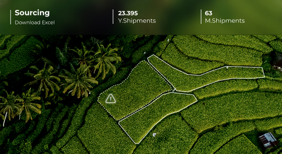
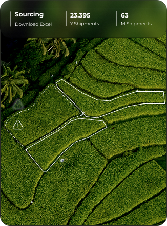
Safeguarding sourcing continuity through scalable compliance
Walter Matter analyzes over 500,000 plots to assess deforestation risk, protect trade flows, and ensure EUDR compliance across complex supply chains.
Building climate-resilient agriculture through smarter soil oversight
BAT reaches over 90,000 contracted farmers with a scalable approach to monitor soil health, erosion, and water retention across their supply chain.

Enabling nature-positive policy through nationwide land monitoring
RPA monitors more than 130,000 km² of land to validate sustainable practices and inform biodiversity-focused policy at a national level.