| CARVIEW |


The Agentic GIS Platform
with your data never leaving BigQuery


.png)

.jpg)

Bring geospatial into your cloud ecosystem
Start today:
One Location Intelligence platform for all users
Redefine how GIS serves your organization with an end-to-end platform built for the enterprise. From data analysts to developers, CARTO’s tools make spatial analysis accessible to everyone.
Powerful spatial analysis, the low-code way
- Automated analysis with drag-and-drop interface
- 100+ ready-to-go analysis components with native ML & AI integrations
- Automate deployment with APIs, AI Agents & MCP tools


Unmatched data visualization capabilities
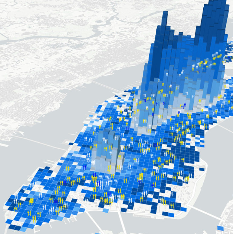
- Billions of data points visualized with ease
- Interact with maps & dashboards through natural language
- Instant insights for all users with AI Agents
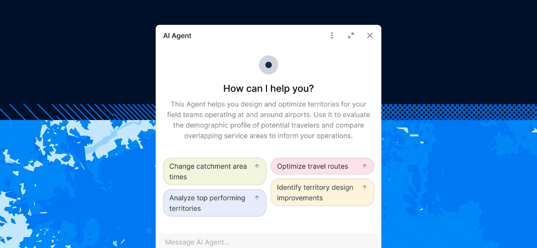
AI Agents for more accessible insights
- Build custom AI Agents & tools tailored to your needs
- Support end-to-end decision-making for your whole organization
- Enterprise-grade: your models, end-points & cloud

Accelerated, scalable app development
- No complex back-end ETLs; apps run in your data lakehouse
- Enterprise-grade, framework-agnostic development
- Visualization using deck.gl, web-GL and GPU technology
Get inspired by our customers
"Using CARTO has allowed us to analyze large amounts of spatial data for 5G deployment at scale and build a creative solution to a complex industry problem."


“By working with CARTO we’ve been able to build the world’s leading telco data monetization solution (Vodafone Analytics) for Tourism, Real Estate & Retail - turning mobile event data into highly valuable spatial insights in 5 countries.”
.jpeg)
.png)
CARTO empowers our underwriters to leverage their deep industry knowledge and experience for strategic decision-making and agent engagement, rather than spending time managing data.


In our journey towards a fully self-serve model, we’ve been exploring ways to put mobility insights directly into the hands of our teams. CARTO’s approach, using AI Agents built on the Agentic GIS platform, makes this possible.
.jpeg)

With CARTO’s AI Agents, predictive growth insights move beyond data analysts and into the hands of every decision-maker. Now, anyone can ask our data questions like ‘Which neighborhoods will grow fastest?’ and get instant answers - speeding up site planning and providing a real competitive edge.

At EQT, we constantly seek ways to enhance the strategic value of our investments and improve the decision-making process. CARTO has been a game-changer for EQT, their cloud-native platform, seamless data integration, Builder for visualization and Analytics Toolbox make it much easier for us to assess investment opportunities and provide strategic advice to our portfolio companies.

The ability to scale our data is a big selling point, as well as the features in the Analytics Toolbox. I also love how easy it is to plot something using CARTO Workflows. As a team leader, I am looking forward to what we can create and achieve using CARTO.


CARTO has allowed us to move away from disparate solutions to one single app to understand site performance across our dealership network in Europe, which has enabled us tobe more data-driven & increase sales.

Many firms are still using PDF reports and Powerpoint. Using CARTO, we are now moving beyond static information to provide digital solutions and a superior experience. By giving our consultants an unprecedented amount of information on locations, we can achieve our goals faster - using data to move away from traditional intuition-based decision-making.

What’s happening in your industry?
Managing asset and risk data at scale can be complex and costly. CARTO helps you to work with hyper-local risk intelligence to optimize decision-making and reduce expenses.

Decision-making with vast amounts of sensitive data requires robust security and real-time capabilities. Ensure data privacy while leveraging live insights for on-demand network planning.

Rigid, legacy data systems slow down decision-making in a fast-moving market. Use CARTO for flexible, seamless analytics and easily make smarter financial decisions.

Integrating massive datasets across multiple sources can be overwhelming. Seamlessly combine Location Intelligence for smarter omnichannel retail decisions.
Reaching the right audience requires precision at scale. Leverage hyper-local data to pinpoint target customers and maximize ROI.

Optimizing fleets and planning mobility at scale is complex and resource-intensive. Leverage advanced spatial analytics to enhance efficiency, reduce costs, and streamline logistics operations.

Check out our resources & join our
growing spatial community
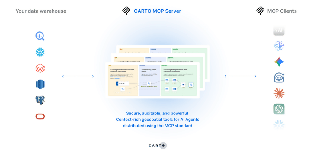
Discover what’s new in CARTO Q4 2025, including Agentic GIS, AI-powered spatial analysis, MCP tools, analytics on embeddings, and enterprise governance updates.
Agentic GIS transforms spatial analysis, automating workflows and delivering instant insights to everyone in an organization, as shown by BT, Cotality, and Virt
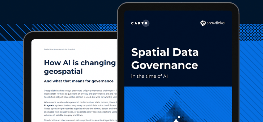
Download this report to learn how to bring spatial data into your governance strategy, so your analyses stay accurate, auditable, and compliant.
TALK TO US
Request a demo
Schedule a 20-minute meeting with our experts to understand how you can use spatial analysis in your organization.