You signed in with another tab or window. Reload to refresh your session.You signed out in another tab or window. Reload to refresh your session.You switched accounts on another tab or window. Reload to refresh your session.Dismiss alert
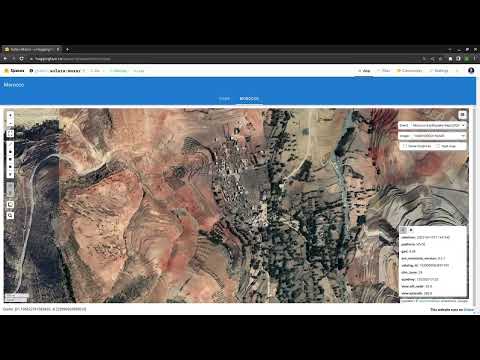
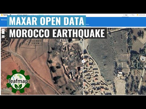
The Maxar Open Data Program provides pre- and post-event high-resolution satellite imagery in support of emergency planning, risk assessment, monitoring of staging areas and emergency response, damage assessment, and recovery. Check out the links below for more information.
The Maxar Open Data STAC catalog URL is: https://maxar-opendata.s3.amazonaws.com/events/catalog.json. The repo contains the catalog in various formats, including GeoJSON, CSV, and MosaicJSON. This makes it easier to use the datasets with Python and other programming languages.
Examples
Visualizing image footprints
importleafmapm=leafmap.Map(center=[36.844461, 37.386475], zoom=8)
url='https://github.com/opengeos/maxar-open-data/raw/master/datasets/Kahramanmaras-turkey-earthquake-23.geojson'm.add_geojson(url, layer_name="Footprints")
m
Visualizing COG mosaic
m=leafmap.Map()
url='https://open.gishub.org/maxar-open-data/datasets/Kahramanmaras-turkey-earthquake-23/1050050044DE7E00.json'm.add_stac_layer(url, name="Mosaic")
m