You signed in with another tab or window. Reload to refresh your session.You signed out in another tab or window. Reload to refresh your session.You switched accounts on another tab or window. Reload to refresh your session.Dismiss alert
Aiming at the problem that the differences in heterogeneous remote sensing images in imaging modes, time phases, and resolutions make matching difficult, a new deep learning feature matching method is proposed. The results show that the algorithm in this paper has strong adaptability and robustness, and is superior to other algorithms in terms of the number and distribution of matching points, efficiency, and adaptability.
This repository contains the implementation of the following paper:
"Deep learning algorithm for feature matching of cross modality remote sensing images" (in Chinese)
异源遥感影像特征匹配的深度学习算法
The main idea and code of feature extracting in this repository are based on D2-Net.
Matching result:
Matching result between google earth images (in 2009 & 2018)
Matching result between uav optical image and thermal infrared image
Matching result between SAR image (GF-3) & optical satellite(ZY-3) image
Matching result between satellite image & map
Getting start:
Python 3.7+ is recommended for running our code. Conda can be used to install the required packages:
Dependencies
PyTorch 1.4.0+
OpenCV
SciPy
Matplotlib
skimage
Dataset
We collected a set of test data named "df-sm-data", including images from space-borne SAR and visible light sensors, drone thermal infrared sensors, and Google Earth images. You may find them in the directory "df-sm-data" in this repository.
Downloading the models
The off-the-shelf VGG16 weights and their tuned counterpart can be downloaded by running:
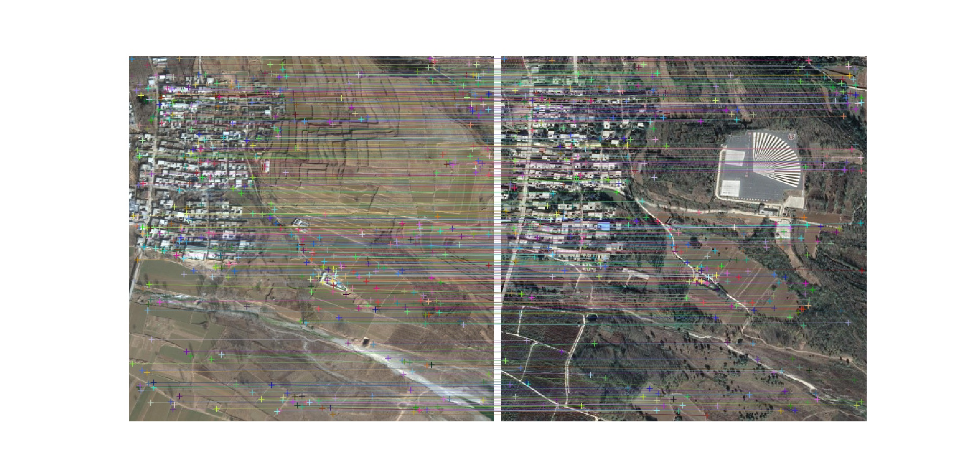 Matching result between google earth images (in 2009 & 2018)
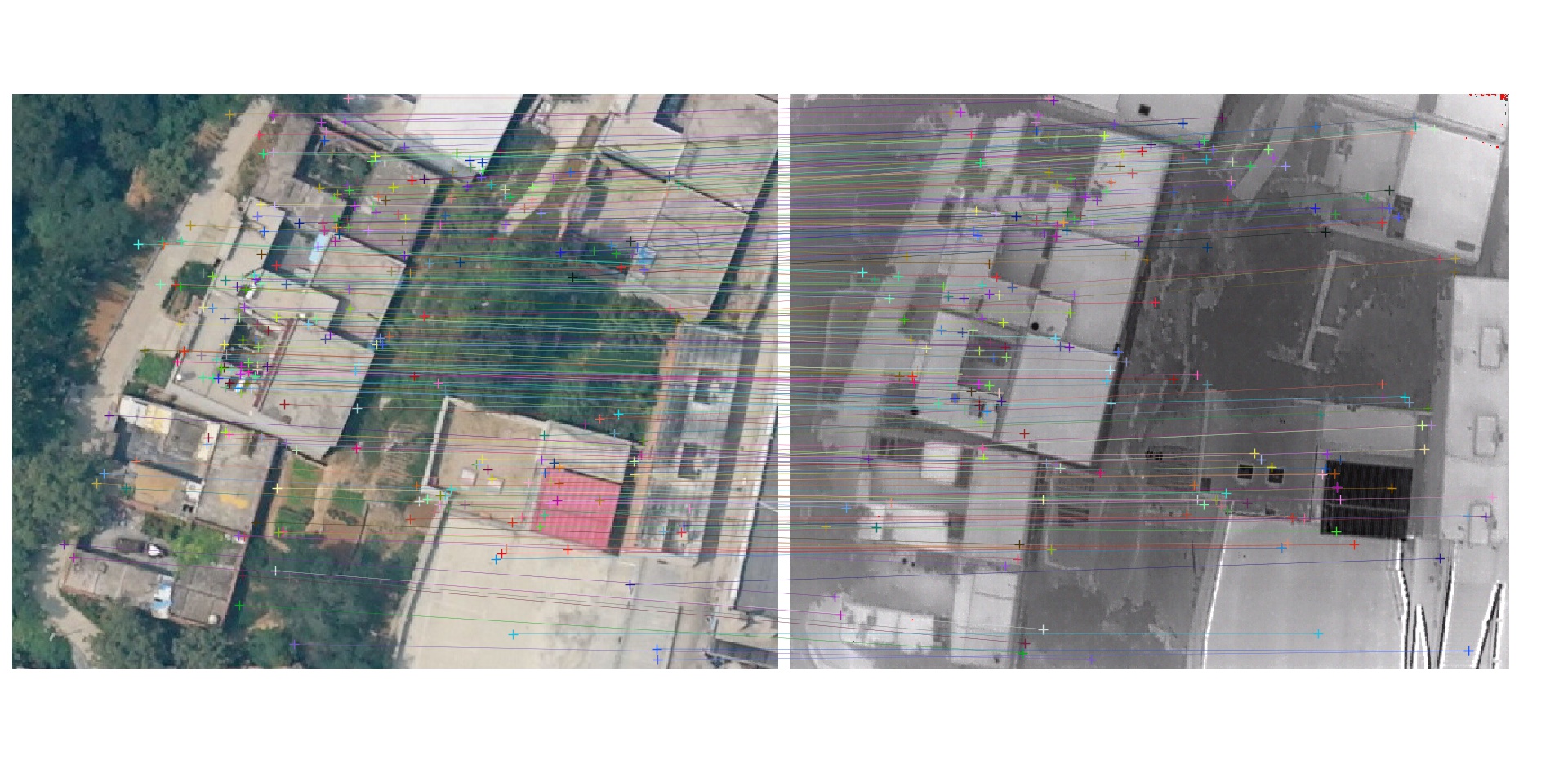 Matching result between uav optical image and thermal infrared image
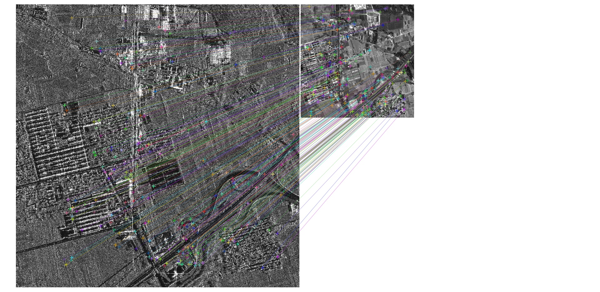 Matching result between SAR image (GF-3) & optical satellite(ZY-3) image
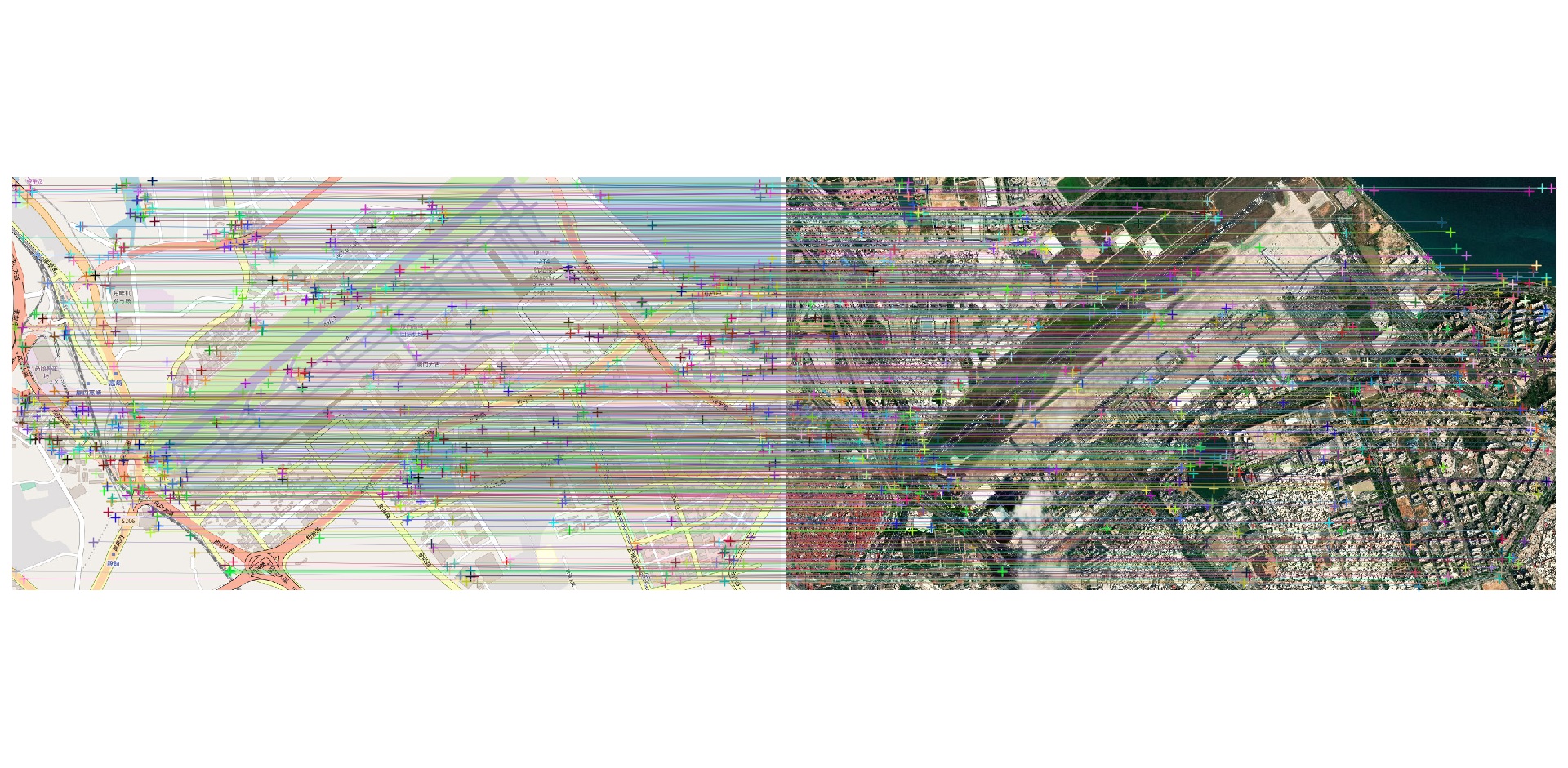 Matching result between satellite image & map